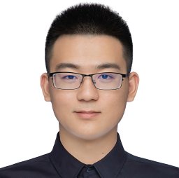
Dr Wanli Ma
Postdoctoral Research Fellow | Practical AI
Computer Vision, Earth Observation, Robotics
University of Cambridge
Cambridge, CB2 1PZ, UK
wm369*at*cam.ac.uk

About
I am a Postdoctoral Research Fellow at the University of Cambridge. I currently work within the Cambridge Centre for Smart Infrastructure and Construction (CSIC), under the supervision of Prof Brian Sheil, developing computer vision techniques (spanning image and video understanding to 3D/4D model generation) for measuring and monitoring construction productivity on site. My work bridges advances in visual reconstruction and scene understanding with the practical challenge of tracking construction progress, workforce activity, and site efficiency at scale.
Previously, at Cambridge I worked on AI-enabled large-scale disaster damage assessment (e.g., blasts, floods, and fires) as part of the EPSRC-funded MicroBlast project. I completed my PhD in Computer Science at Cardiff University in 2024, within the Visual Computing Group, under the supervision of Dr Oktay Karakus (Remote Sensing) and Prof Paul Rosin (Computer Vision, Fellow of the IAPR). My doctoral thesis, “Towards Minimal Supervision for Semantic Segmentation of Remote Sensing Imagery,” explored techniques to reduce the labelling burden in training machine learning models for satellite remote sensing imagery. Prior to my PhD, I received a Master’s degree with Distinction in Image and Video Communication and Signal Processing from the University of Bristol (2021), where my dissertation focused on “Ship Wake Detection in SAR Imagery Using Dual-Tree Complex Wavelet Transform (DT-CWT).”
My current research centres on computer vision for 3D/4D scene reconstruction — recovering spatial and temporal structure from images and video — and its application to construction productivity measurement, including site progress monitoring, activity recognition, and resource utilisation tracking. I am interested in bridging theoretical advances in AI with practical, real-world deployment, from earth observation to the built environment. My earlier work in remote sensing centred on “minimal supervision” approaches (semi-supervised learning, active learning, and multi-modal fusion) for large-scale disaster damage assessment, marine monitoring, and urban infrastructure detection — reducing the labelling burden in training machine learning models for satellite imagery. Beyond this, I retain a strong interest in applying computer vision to robotics and industrial automation, having previously developed and commercialised automated facilities for the manufacturing sector.
Research Interests
- Single View 3D Reconstruction
- Computer Vision
- Remote Sensing
- Disaster Damage Assessment
- Urban Infrastructure Detection
- Marine Debris Detection
- Robotics
- Biomedical Image Computing
- Inverse Problem
Highlights
- Cardiff 30(ish) Awards, 2026
- Exceptional Talent Endorsed by UKRI under the EPSRC Project MicroBlast, 2025
- Fellow of Outstanding Young Scholars Society UK (OYSS), 2025
- Postdoctoral Affiliate at Clare Hall, University of Cambridge, 2025
- First Prize in China International Aircraft Design Challenge (CADC) Competition, 2016
- Ranked No. 2 Machine Vision for Earth Observation and Environment Monitoring (MVEO) Competition in the British Machine Vision Conference, 2023 (Ranked No. 3 in 2025)
- 2nd Prize in National College Students Photoelectric Design Competition (CPDC), 2017
- Awarded a Competitive Full PhD Scholarship by Cardiff University, 2021
- MSc (Distinction), University of Bristol, 2020
- BSc (First Class Honours), China Jiliang University, 2019
Skills
Programming / 8 Years
Proficient in Python & C++; Specialist in Qt & MFC GUI development.
Deep Learning
Expertise in PyTorch & TorchGeo for machine learning algorithm development.
GIS Software
Expertise in QGIS and SNAP for satellite data processing and analysis.
Scientific Tools
Expertise in LaTeX for scientific writing, and Git for collaborative research.
Data Analysis & Visualisation
Proficient in Pandas, NumPy, Matplotlib, Seaborn, and Plotly for data processing and visualisation.
Cloud & DevOps
Experience with Docker, GitHub Actions, and deploying ML models in cloud environments.
Project Management & Collaboration
Skilled in agile methodologies, team collaboration, and problem-solving.
Languages
Fluent in English and Chinese; familiar with scientific and technical writing standards.
Recent News & Activities
- 24 Aug 2026: I am co-organising the BMVC Workshop on Machine Vision for Earth Observation, Environmental Monitoring, and Climate Change.
- 16 Aug 2026: A paper has been accepted for publication in the Q1-ranked IEEE Journal of Selected Topics in Applied Earth Observations and Remote Sensing (J-STARS).
- 10 Aug 2026: I virtually presented our building damage assessment work at the International Geoscience and Remote Sensing Symposium (IGARSS) 2026.
- 01 Aug 2026: I started a new postdoctoral appointment at the University of Cambridge, Laing O'Rourke Centre.
- 12 Jun 2026: The TUM Data Innovation Lab approved our collaboration research project on Interactive World-Action Models, involving six master’s students from TUM.
- 19 May 2026: Invited to give a presentation at the workshop AI for Post-earthquake Management: Capacity, Skills & Policy, funded by the British Council.
- 07 May 2026: A paper has been submitted to the flagship artificial intelligence conference, NeurIPS 2026.
- 03-08 May 2026: Attended the 2026 EGU General Assembly in Vienna.
- 07 Apr 2026: A paper has been published by the Q1 journal Science of Remote Sensing.
- 19 Mar 2026: Two papers have been accepted by the flagship remote sensing conference, International Geoscience and Remote Sensing Symposium (IGARSS) 2026.
- 13 Mar 2026: A paper has been submitted to the Q1 journal IEEE Transactions on Geoscience and Remote Sensing (TGRS).
- 06 Mar 2026: A paper has been submitted to the Q1 journal IEEE Selected Topics in Applied Earth Observations and Remote Sensing (J-STARS).
- 27 Feb 2026: A paper has been submitted to the flagship computer vision conference, European Conference on Computer Vision (ECCV 2026).
- 23 Feb 2026: An abstract has been accepted by the flagship remote sensing conference, EGU 2026.
- 31 Jan 2026: A paper has been published in the journal IEEE Access.
- 27 Nov 2025: Ranked No.3 among 48 teams from the world in the Machine Vision for Earth Observation (MVEO) contest and delivered our solution presentation at the British Machine Vision Conference (BMVC) in Sheffield.
- 15 Oct 2025: A paper has been published in the Q1 journal Neurocomputing.
- 03-08 Aug 2025: Attended the flagship international remote sensing conference, International Geoscience and Remote Sensing Symposium (IGARSS) 2025 in Brisbane, Australia, delivered two oral presentations, and chaired a poster session.
- 14 Jul 2025: Invited to deliver a presentation at an Engineering School seminar at the University of Sheffield on building damage assessment using AI and remote sensing.
- 19 Jun 2025: Being an Affiliated Postdoctoral Member of Clare Hall, University of Cambridge. [Link]
- 27 May 2025: A paper has been published for publication in the Q1-ranked IEEE Journal of Selected Topics in Applied Earth Observations and Remote Sensing (J-STARS). [Link]
- 12 May 2025: Passed PhD viva with minor corrections. Grateful for the invaluable support from Oktay and Paul throughout this journey.
- 24 Apr 2025: Awarded travel grant from IEEE Geoscience and Remote Sensing Society.
- 21 Apr 2025: Collaborative project completed — Mw-7.7 Earthquake Impact Assessment in Myanmar and Thailand using Remote Sensing Data, Accessible on Zenodo and MapBox.
- 19 Mar 2025: A paper has been accepted to the flagship international remote sensing conference, the IEEE International Geoscience and Remote Sensing Symposium (IGARSS 2025)![Link]
Publications
Selected papers
- Rapid Assessment of Blast-Induced Structural Damage Using a Physics-based Multimodal Network. W Ma, S Selvakumaran, DG Farrimond, AA Dennis, SE Rigby, JSTARS, 2026
- Integrating Semi-Supervised and Active Learning for Semantic Segmentation. W Ma, O Karakuş, PL Rosin, Science of Remote Sensing, 2026
- Core-Set Selection for Data-efficient Land Cover Segmentation. K Nogueira, A Zaytar, W Ma, et al., IEEE Access, 2026
- EHIN: Early-Aware Hierarchical Interaction Network for Weakly-Supervised Referring Image Segmentation. H Li, A Chen, J Liu, W Ma, W Liu, Y Ju, H Liu, W Zhou, Neurocomputing, 2025
- DiverseNet: Decision Diversified Semi-supervised Semantic Segmentation Networks for Remote Sensing Imagery. W Ma, O Karakuş, PL Rosin, JSTARS, 2025
- Patch-GAN Transfer Learning with Reconstructive Models for Cloud Removal. W Ma, O Karakuş, PL Rosin, IGARSS, 2025
- Knowledge distillation for road detection based on cross-model semi-supervised learning. W Ma, O Karakuş, PL Rosin, IGARSS, 2024
- Land Cover Classification Using Attention-Based Multi-Modal Image Fusion. O Karakuş, W Ma, PL Rosin, Signal and Image Processing for Remote Sensing, 309, 2024
- High-precision density mapping of marine debris and floating plastics via satellite imagery. H Booth, W Ma, O Karakuş, Scientific Reports 13 (1), 6822, 2023
- Confidence guided semi-supervised learning in land cover classification. W Ma, O Karakuş, PL Rosin, IGARSS, 2023
- AMM-FuseNet: Attention-based multi-modal image fusion network for land cover mapping. W Ma, O Karakuş, PL Rosin, Remote Sensing 14 (18), 4458, 2022
- Exploiting the dual-tree complex wavelet transform for ship wake detection in SAR imagery. W Ma, A Achim, O Karakuş, ICASSP, 2021
Oral & Poster Presentations
- Oral Presentation: The International Geoscience and Remote Sensing Symposium (IGARSS), Brisbane, Australia, 03-08 Aug 2025
- Oral Presentation: The International Geoscience and Remote Sensing Symposium (IGARSS), Athens, Greece, 07-12 Jul. 2024
- Oral Presentation: The British Machine Vision Conference (BMVC), Aberdeen, UK, 20-24 Nov. 2023
- Oral Presentation: The International Geoscience and Remote Sensing Symposium (IGARSS), Pasadena, US, 16-21 Jul. 2023
- Poster: The British Machine Vision Association (BMVA) Summer School, Norwich, UK, 11-15 Jul. 2022
- Poster: Vision Researchers Colloquium 2022, Cardiff, UK, 4 Jul. 2022
- Poster: Special Event: The British Machine Vision Association (BMVA) 3 Day Symposium, Manchester, UK, 4-6 Apr. 2022
- Oral Presentation: IEEE International Conference on Acoustics, Speech, and Signal Processing (ICASSP), Toronto, CA (Virtually), 6-11 Jun. 2021
Teaching and Supervision
- Postgraduate module related to Machine Learning, enrollment: 150+ students(Since 2022)
- Undergraduate module related to Data Structures, enrollment: 150+ students (Since 2024)
- Summer courses “Python Programming” and “Machine Learning and Its Applications” (Since 2025)
- Teaching two courses, each enrolling over 30 undergraduate students annually.
- Python Programming: data type & structures, function, file I/O.
- Machine Learning and Its Applications: focus on practical and theoretical aspects of machine learning, including supervised/unsupervised learning, neural networks, and model evaluation.
- Machine Learning and Its Applications: guided students through a series of hands-on projects applying AI techniques to detect and analyse urban buildings from remote sensing imagery.
- Diya Thomas, postgraduate at the University of Cambridge. Vision Foundation Models for Disaster Damage Assessment. (2026)
- Ningxin He, undergraduate at the National University of Singapore. Machine Learning Approaches for Earthquake-induced Building Damage Assessment. (2025)
- Xiaoyu Zhang, undergraduate at the University of Cambridge. Reinforcement Learning-based Control for Robotic Hoisting in Construction Environments (2025)
- Henry Booth, postgraduate at Cardiff University. Marine Debris Detection Using Deep Learning Networks. Now at the Met Office. (2023)
- Naga Padala, postgraduate at Cardiff University. Integrating PCA, HSV, and Raw Remote Sensing Data via Deep Learning for Land Cover Classification. (2022)
Teaching
I have over two years of teaching experience in the computer science discipline, includingSupervision
Collaboration
- University of Sheffield (2025 – present): Collaborating on blast-loading-informed building damage assessment, with the Sheffield team providing blast-loading simulations for the 2020 Beirut explosion area.
- Chinese Academy of Sciences (2025 - present): Co-developed landslide detection methods based on computer vision and satellite remote sensing imagery.
- Cardiff University (2025 - present):
- Knowledge distillation from various foundation models for semantic segmentation of remote sensing imagery, with regular meetings to discuss technological developments.
- Robot operation and hoisting: collaborating with Cardiff, which provides a simulation environment for soft-object manipulation, while we develop object state prediction and reinforcement learning–based control algorithms.
- AI for Good Lab – Microsoft Research (2023-2024): A collaboration focused on geospatial analytics, applying AI to extract actionable insights and structured information from spatial data, including satellite and aerial imagery. Specifically, we explored automated methods for selecting the most informative coresets from large-scale datasets for land cover mapping to reduce the workload for labelling.
- The German Aerospace Centre (DLR) (2023-2026):
- Collaborated on coreset selection, with DLR providing large-scale satellite datasets for label cover mapping.
- Collaborated on AI for physics-informed building damage assessment, with DLR providing building damage data for the 2020 Beirut Explosion.
Academic Services
- Reviewer for Artificial Intelligence Journals: IEEE Transactions on Image Processing (T-IP), IEEE Transactions on Neural Networks and Learning Systems (T-NNLS), IEEE Transactions on Circuits and Systems for Video Technology (T-CSVT), Neurocomputing, Digital Signal Processing (DSP).
- Reviewer for Remote Sensing Journals: IEEE Journal of Selected Topics in Applied Earth Observations and Remote Sensing (J-STARS), International Journal of Applied Earth Observation and Geoinformation (JAG). GIScience & Remote Sensing (GRS), Remote Sensing (RS), Scientific Reports (SR).
- Reviewer for Robotics Journals: IEEE Transactions on Automation Science and Engineering (T-ASE).
- Session Chair: "Remote Sensing Image Reconstruction, Processing, and Enhancement" in IEEE International Geoscience and Remote Sensing Symposium (IGARSS) 2025.
- Organiser for Workshops: Machine Vision for Earth Observation, Environmental Monitoring, and Climate Change in BMVC 2026.